

Tennessee explorers can take in two expansive views and also explore a unique boulder field littered with crags, caves and climbing paths atop Black Mountain, a peak just off of I-40 between Crossville and Knoxville, not far from the town of Crab Orchard, Tennessee.
With areas now part of the very lengthy Cumberland Trail State Park system—a “linear park” still in development—Black Mountain reaches 2,900 feet above sea level at its summit, towering above the surrounding valleys.
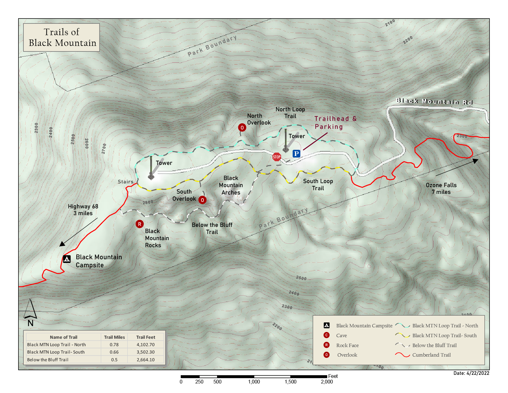
Features here, at the portion of the Cumberland Trail State Park near the Black Mountain Overlook, include three trail segments, two overlooks and a beautiful piece of wooded hilltop Tennessee terrain.
The trails, in three distinct sections totaling just under two miles altogether, involve the north section of the Black Mountain Loop Trail, the south section of the Black Mountain Loop Trail, and a portion known as the Below the Bluff Trail.
An adventure begins—while still in your vehicle—with a secluded climb up Owl Roost Road, a very narrow, winding mountain road that snakes uphill. This car ride alone may be enough to strike a bit of wild spirit and fear into the hearts of city folk.
Finally, after a couple of miles of steep travel, this road leads to a somewhat strange parking area—a paved lot next to a high cellphone tower with no real amenities or clear markings, but this is the place (the main road continues onward from here but is blocked off).
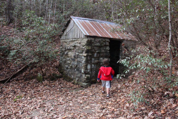
After a quick walk down a foot trail setting off from nearby the cell tower, hikers arrive at a map covered by a little roof, a fixture at Tennessee State Parks and a more proper trailhead. The ruins of an old chimney and a small springhouse constructed of stone sit nearby.
At this point, visitors may embark on the loop trail and crest the hill while venturing to one of the overlooks, or choose the Below the Bluff Trail, which takes a lower path.
Great sights await with either option.
Exploring all three of the brief trail sections would require a little doubling back at some point.

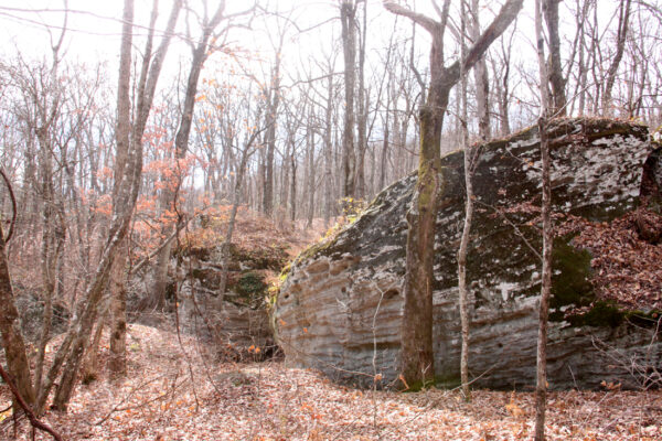
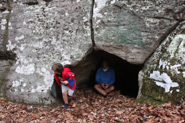
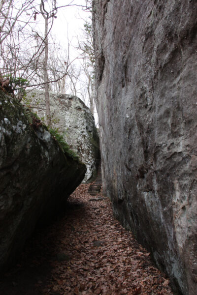
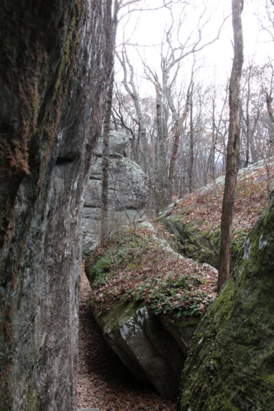
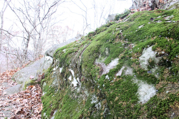
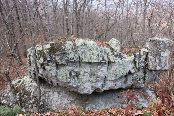
Choosing the Below the Bluff section soon leads down to some very interesting large rock formations with various nooks and crannies and narrows to explore.
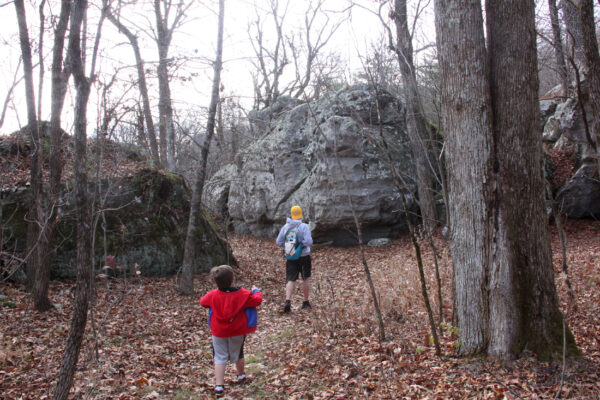
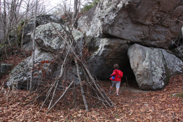
Continuing on, hikers will see huge boulders scattered about, a great area for rock climbing, more so for bouldering work than sheer cliff face to climb.
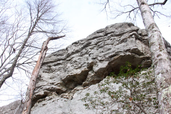
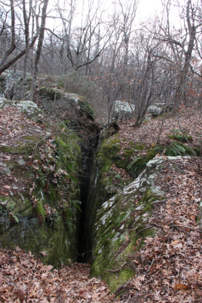
There’s cool little caves and crags cut into the rocks for those of all skill levels to discover.
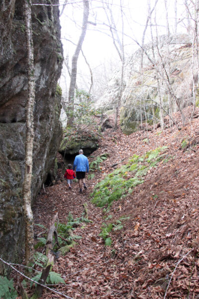
This half-mile Below the Bluff trail will eventually connect to the main Cumberland Trail, not far from the Black Mountain Campground.
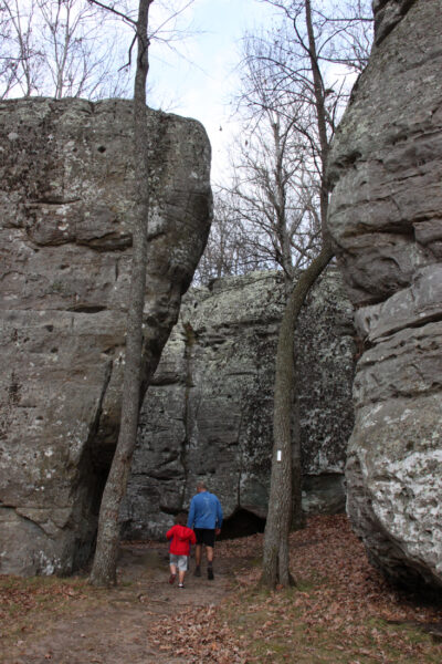
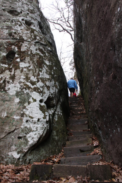
After taking this back toward the loop for a short bit, a staircase leads up a narrow crag in the rocks. Climbing these stairs leads back to the top of the bluff and the north segment of the loop trail.
Leaves cover the footpath on a breezy November afternoon. Just 40 miles away, the Tennessee trees were packed with their lively fall colors, while all of the leaves atop Black Mountain had already fallen by mid-November, leaving the trees totally bare. It’s a different type of terrain up on Black Mountain; quiet, still and removed.
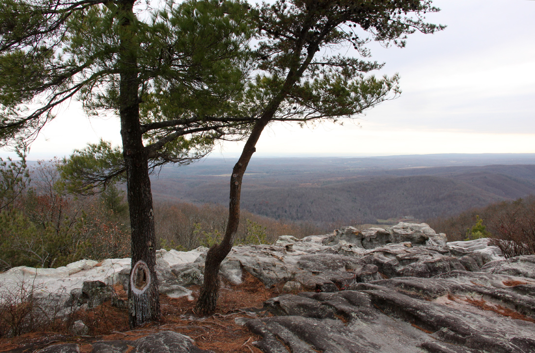
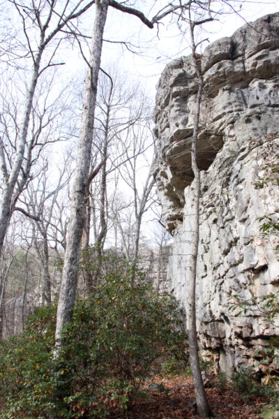
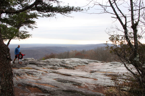
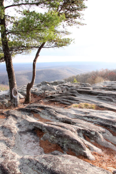
The northern loop trail will guide explorers to one of the park’s overlooks, a large rock where visitors can see striking scenes of faraway towns and valleys.
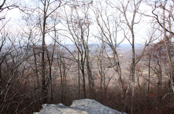
Those taking a moment to gaze past the trees can see tiny-looking cars and trucks on the interstate from here, over three miles away, traveling along silently in the distance.
Continuing along the loop trail will eventually lead back past the cell tower at the parking lot, and then back to the map and the chimney at the cross point, where hikers can then continue on the loop, rather than the Below the Bluff section.
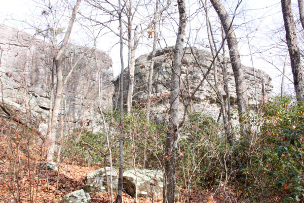
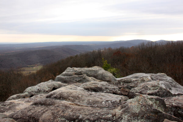
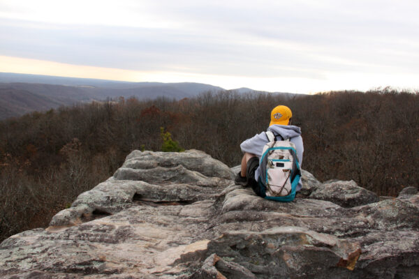
This will soon lead to another overlook rock, this point on the south side of the summit.
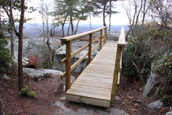
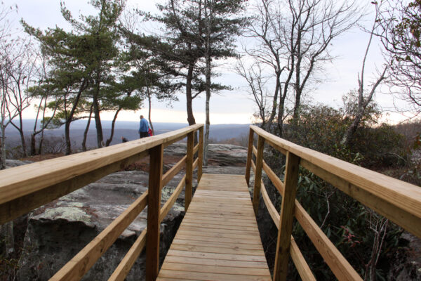
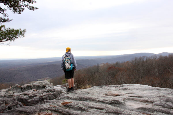
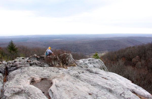
Sight lines here reach even farther than those from the northern overlook, with explorers seeing the faraway peaks of the Smokies way off in the distance.
Impressive. Stunning, humbling views can be had from the south overlook, where visitors can see faint mountain peaks in the distance probably 50-plus miles away.
The Black Mountain area of the Cumberland Trail offers a quick taste of the Appalachian vibe, just outside of Middle Tennessee, but within sight of the Smokies from its high vantage point.
A visit could be a quick excursion. One could travel from I-40, up the mountain, to the parking area and to an overlook fairly quickly if they knew where they were going.
A party could take their time exploring the peak of Black Mountain, leisurely wandering the forest, climbing boulders for a bit, ducking into a crag or perching on a rock for a picnic and taking in the memorable views, unrushed.
Or, the ambitious could arrive and leave the area via the Cumberland Trail.
This lengthy system of trails will eventually span the height of Tennessee and will include nearly 300 miles of trails from Cumberland Gap on the Tennessee, Virginia and Kentucky border to the Tennessee River Gorge, near Chattanooga, according to information from Tennessee State Parks.
“The completed trail corridor will encompass the largest acreage within a Tennessee State Park unit,” according to Tennessee State Parks. “The Cumberland Trail follows a line of pristine high ridges and deep gorges lying along Tennessee’s Cumberland Plateau, linking State Park lands, State Natural Areas, Wildlife Management Areas, and National Parks.”
The trail is sprinkled with rustic campground areas suitable for longer, multi-day hikes, and has been designed as an alternative experience to the sometimes-crowded Appalachian Trail.
“It gives hikers access to areas preserved for their natural or scenic beauty, providing a wilderness experience rare in the eastern U.S. The rugged trail follows numerous sparsely populated ridge lines where the trail designers have strategically routed the trail to spectacular overlooks.”
Black Mountain Overlook
3004 Owl Roost Rd.
Crab Orchard, Tennessee
view a high resolution map of the Black Mountain trails here