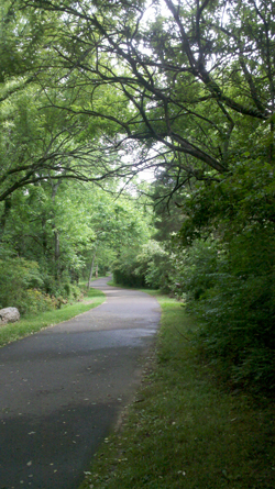
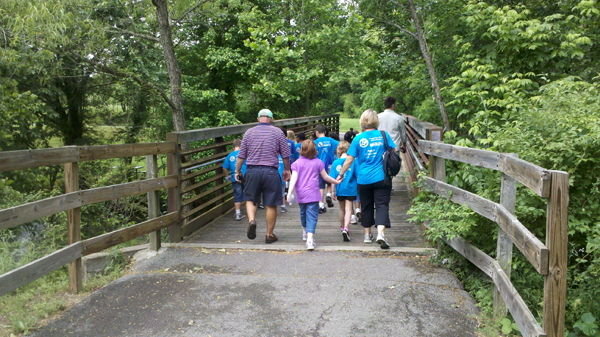
The Murfreesboro Greenway system is not just a sidewalk—it can probably be best described as a “linear” park. Miles and miles of beautiful and peaceful trails, interspersed with picnic tables, playgrounds, pavilions, historic sites, water access and more.
The Greenway system was designed with connectivity in mind, connecting many of Murfreesboro’s interesting and important destinations. It is intended to be used recreationally, but also intended to be used as a travel corridor for foot, bicycle and alternative transportation methods. Currently the Greenway connects Cannonsburgh, Old Fort Park, Fort Rosecrans, and will eventually connect to Barfield Park and other sites.
There are currently 11 trailheads open to the public on the Greenway system:
Cannonsburgh Village Trailhead is located at 312 Front Street, near the heart of downtown Murfreesboro. Parking is available and restrooms are located in the Cannonsburgh Village area.
Fortress Rosecrans Trailhead is located at 1916 Golf Lane inside the Old Fort Park. This trailhead is near some very significant Civil War sites. Historical information is posted along the trail.
Old Fort Park Trailhead is located at 916 Golf Lane and is the site of the Kid’s Castle Playground area and tennis courts.
Overall Street Trailhead is located at 410 Overall St. This trailhead is near the rear of Old Fort Park and has a small parking area.
Cason Trailhead is located at 1100 Cason Trail. This trailhead is the newest addition to the system and features children’s playground areas and pavilions.
Manson Pike Trailhead is located at 1208 Searcy Steet at the corner of Medical Center Parkway. This trailhead is close to the Ransom’s Mill dam and also has a boat ramp for small watercraft.

Redoubt Brannan Trailhead is located at 1300 West College Street. This part of the Greenway is across from the remains of a Civil War fortification that was a part of Fortress Rosecrans and an area used by Union Troops to guard the railroads passing through Murfreesboro.
General Bragg Trailhead is located at 1540 W. College Street and is about halfway between the Thompson Lane and Fortress Rosecrans Trailheads. A large parking lot is just off of West College Street. This trailhead is very popular with pet owners because of its proximity to the BARK PARK. A playground and picnic pavilion is also located at this trailhead. A side trail near the pavilion connects to the Stones River National Battlefield.
West College Street Trailhead is located at 1902 W. College Street. This new trailhead accesses a two mile loop around a small lake and provides access to Gateway Island, a reception center and gazebo.
Broad Street Trailhead is located at 1921 N.W. Broad Street near Thompson Lane and 84 Lumber. This trailhead has excellent views of Stones River.
Thompson Lane Trailhead is located at 2240 N. Thompson Lane and is the site of the McFadden Farm property. An Artillery Monument marks the site of one of the Civil War’s bloodiest battles. Water access is also available at this trailhead.
Click here for a full map of the Greenway
The Greenway System is a great success at providing Murfreesboro a multi-purpose use area, suitable for strollers, toddlers, seniors, citizens with disabilities, school groups, church groups and more. The system can be used for exercise, recreation, fishing and boating. Information about pavilion rental can be obtained by calling 890-5333.
Friends of the Greenway (FOG) is a volunteer organization designed to assist the Parks and Recreation Department in realizing many of the present and future goals of the Greenway system. For more information about FOG, please call 893-2141 or contact Angela Jackson of the Parks and Recreation Department at ajackson@murfreesborotn.gov.


